करमदाहा घाट एवं मंदिर, जामताड़ा, दुमका (Karamdaha Ghat & Temple) – Jamtara, Dumka

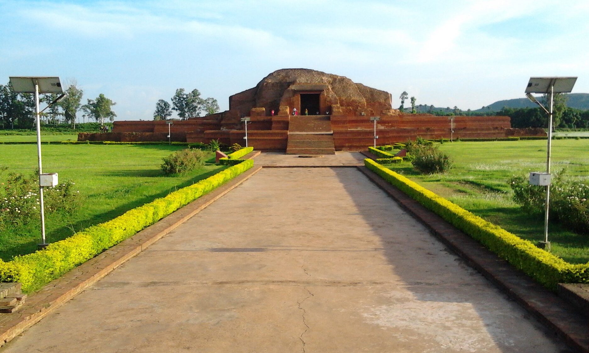
When you visit Jamtara, you can easily visit two places, i.e., Karamdaha Ghat and Karamdaha Temple at the same time – a very beautiful picturesque place.

Karamdaha Mandir, Jamtara

Karamdaha Temple is one of the most famous temples dedicated to Dukhiya Mahadev and is located just 44 kms away from Jamtara Railway Junction. Instead of normal days, this temple is occupied during specific festivals;

In addition, every year on the occasion of Makar Sankranti a 15-day Karamdaha fair is held.

In the said fair, shopkeepers come from the neighboring cities as well as from the provinces of West Bengal, Orissa, Bihar etc.

Karamdaha Ghat, Jamtara

People's faith and faith in Karamdaha Dukhiya Mahadev is unwavering. A large number of people reach Karamdaha to see the fair. The people who go to the fair first take a holy bath in the Barakar river and then enjoy the fair only after paying obeisance at the rate of Dukhiya Mahadev. <…

Read more about करमदाहा घाट एवं मंदिर, जामताड़ा, दुमका (Karamdaha Ghat & Temple) – Jamtara, Dumka
  • 0

लाधना डैम, जामताड़ा, दुमका (Ladhna Dam) – Jamtara, Dumka

Ladhna Dam is a famous tourist spot in Jamtara and surrounding areas. In Ladhna, the Ghat of Damodar river on one side and the attractive mountain on the other side attracts every people towards it. This place is full of natural shade.

This place is considered a peaceful and beautiful place for the tourists coming for picnic. In the months of December, January and February, people including their families from Asansol, Chittaranjan, Jamtara, Rupnarayanpur etc. come to this place to celebrate picnic.

Ladhna Dam, Jamtara

A large number of tourists are reaching Ladhna for picnic.

Despite the lack of drinking water arrangement at the picnic spot, tourists reach here in hundreds.

Ladhna Dam, Jamtara

Ladhna village is situated on the banks of Damodar river. Here the meeting of the mountain range and the dam presents a pleasant and picturesque shade.

The name of this place has spread far and wide due to the hal…

Read more about लाधना डैम, जामताड़ा, दुमका (Ladhna Dam) – Jamtara, Dumka
  • 0

सुन्दर डैम, गोड्डा (Sundar Dam) – Godda

Sundar Dam, Godda

Sundar dam is the biggest irrigatoinal project in this district constructed on Sundar river near village north-east of Pathargama and this is a beautiful picnic spot for the tourist. There are plenty of picnic spots in the area around the famous Sundar Dam, located at a distance of about 30 km from the district headquarters.

Sundar Dam is located in the hilly area of ​​Boarijor block. The natural shade here is breathtaking. Apart from the dam, there is a mountain range which touches the hill of the palace and goes far. Pahariya community also resides on top of this hill.

The view of the hill waterfall is also seen in the surrounding area. Just a short distance away from this is the Damakol Falls, which is in the wooded area of ​​Sundar Pahari.

The dam is having 75 Ft. depth was constructed between 1970-78

How to Reach: By Air

Nearest airport is Netaji Subhas Chandra Bose Airport, Kolkata and Birsa Munda Ai…

Read more about सुन्दर डैम, गोड्डा (Sundar Dam) – Godda
  • 0

कच्चूदह झील, किशनगंज, पूर्णिया (Kachuudah Lake, Kishanganj) – Purnea

This beautiful natural lake is located 40 km from Kishanganj. It is home to hundreds of migratory birds that make it their temporary home. Recently the Tourism Department, Government of Bihar, sanctioned money for the beautification and development of the area around the lake for promoting local tourism.

Kachuudah Lake, Kishanganj

The specialty of this lake, which encompasses the limitless possibilities of tourism, is that there is an island in the middle of this lake spread all around.

A large number of migratory birds start arriving here from the month of November itself. Tourist birds come here and after breeding in four months give children here and leave here in March.

This place has also been named as Gateway of Himalayas.The Kachhudah site is located only at a distance of six kilometers from the city of Thakurganj.

The view becomes even more picturesque when the birds are roaming in the lake.

Read more about कच्चूदह झील, किशनगंज, पूर्णिया (Kachuudah Lake, Kishanganj) – Purnea
  • 0

बेणुगढ़, किशनगंज, पूर्णिया (Benugarh, Kishanganj)- Purnea

It is a ruined fort about eight miles west of Bahadurgunj. It is ascribed to Benu Raja, the brother of Asura.

Benugarh Talab

The story goes that there were five brothers who lived in the Vikramaditya period and whose namfes were Asura, Benu, Barijan, Nanha and Kanha. Each of these brothers built a Garh or fottified residence and named it after himself. But the Garhs of the last two brothers are not to be found.

It is believed that Pandavas had stayed here and used the pond to cook their food and take bath.

Read more about बेणुगढ़, किशनगंज, पूर्णिया (Benugarh, Kishanganj)- Purnea
  • 0

गोगाबील झील पक्षी विहार, मनिहारी, पूर्णिया (Gogabil Bird Sanctuary, Manihari) – Purnea

Gogabil is Bihar’s 15th Protected Area and also state’s first Community Reserve. The State Board for Wildlife, under the provision of the Wildlife (Protection) Act 1972, amended in 2002, incorporated Gogabil as Community Reserve and Community Reserve on 2 August, 2019. Gogabil, Bagharbeel and Baldia chaur are important wetlands enlisted in the Important Bird Areas (IBA) of Asia.

Gogabil Bird Sanctuary, Manihari

It is a prototype of oxbow lake of about 1 to 5 km dimension with ample water content round the year. The water body and land area of Gogabil encompass 217 acres area of which 73.78 acres belong to the government while the rest is owned by the local community of Amdabad and Manihari blocks of Katihar district. The area is heavily flooded during monsoons every year with rains and spill over from Kankhar, Mahananda and Ganga rivers. The lake is rich in aquatic flora and fauna providing abundant food attracting migratory birds in the winters. The…

Read more about गोगाबील झील पक्षी विहार, मनिहारी, पूर्णिया (Gogabil Bird Sanctuary, Manihari) – Purnea
  • 0

चंदन बांध, बांका (Chandan Dam) – Banka

Chandan Dam, Banka

चंदन बांध बांका जिला का एक मुख्य आकर्षण स्थल है। चंदन बांका जिला में लक्ष्मीपुर में स्थित है। चंदन बांध बहुत खूबसूरत है। यह चंदन नदी पर बना हुआ है। यह चारों तरफ से पहाड़ियों और जंगल से घिरा हुआ है। चंदन बांध, जब ओवरफ्लो होता है और इसका पानी बहता है। तब बहुत अच्छा लगता है। यहां पर आकर आप अपना बहुत अच्छा समय बिता सकते हैं। 

Chandan Dam, Banka
Read more about चंदन बांध, बांका (Chandan Dam) – Banka
  • 0

बड़ुआ जलाशय, बांका (Badua Dam) – Banka

Badua Dam, Banka

Badua Reservoir is one of the main places to visit in Banka district. This reservoir is located at Bijirvorwa in Banka district. You can spend your good time by coming here. This reservoir is very beautiful. Here you also get to see the mountainous area. This reservoir is spread very far. This reservoir is mainly made for irrigation. When this reservoir overflows. Looks so beautiful then. You can spend your time by coming here.

Read more about बड़ुआ जलाशय, बांका (Badua Dam) – Banka
  • 0

बिलासी बांध, बांका (Bilasi Dam) – Banka

Bilasi Dam - Banka

Bilasi Dam is a major site of Banka district. The Bilasi Dam is located in the village of Fullidumar in Banka district. You can come and roam here. This dam is surrounded by hills on all sides. It is very nice to spend time here in the rainy season. Here you get to see big rocks. Here you can get a beautiful view of the sunset in the evening. You can also enjoy bathing here. This place is very beautiful. This is a picnic spot in Banka.

Bilasi Dam - Banka
Read more about बिलासी बांध, बांका (Bilasi Dam) – Banka
  • 0

पापहरणी सरोवर, बांका (Papharni Pond) – Banka

Papharni Pond, Banka

There is a pond in the foothills of Mandar mountain which is known as Papaharani. There are three paths leading up to the mountain through the vicinity of this pond. Many temples are lying in a dilapidated state under this mountain.

In the center of Papaharani is a panoramic temple of Mahabishnu and Mahalakshmi. Two Jain temples are situated on the top of the mountain. A large number of Jain pilgrims come here to worship Lord Vasupujya. It is believed that this is the nirvana land of Lord Vasupujya.

Papharni Pond, Banka

There are many small ponds on the mountain. Of these, the depth of the Milky Way and the conch shell is satisfactory. Sita Kund is the most famous among these kunds. It is named after the goddess Sita. It is believed that Sita took a bath here.

Papharni Sarovar is a major religious place in Banka district. This lake is built on the foothills of Mandar Hill in Bounsi in Banka district. Here you get to…

Read more about पापहरणी सरोवर, बांका (Papharni Pond) – Banka
  • 0

मनिहारी, पूर्णिया (Manihari) – Purnea

Previously known as Maniharan, this village holds an essential place in Hindu mythology. It is said that Lord Krishna, while travelling through these parts, had lost a valuable here. In Sanskrit, ‘Mani’ means jewel. Hence, the name stayed. Situated on the banks of the River Ganga, this place is famous for Manihari Ghat, a beautiful picnic spot.

Manihari Ghat, Purnea

Manihari is a town and an informed region in Katihar area in the Indian province of Bihar. It has a normal height of 31 meters 101 feet. This place is outstanding for the Manihari ghat, which interfaces it to Sahibganj, which is additionally arranged on the bank of the River Ganges. The town is situated on the banks of the stream Ganges where it meets the waterway Koshi, accordingly making the town inclined to flooding each year. Manihari is a little border town between the conditions of Bihar and Jharkhand. Sahebganj is the area town of Jharkhand which is 9 km from Manihari.

Manihari G…
Read more about मनिहारी, पूर्णिया (Manihari) – Purnea
  • 0

सिमरिआ घाट धाम, बेगूसराय (Simaria Ghat Dham) – Begusarai

Simaria Ghat, Begusarai

Simaria is a village in India along the Ganges river in Begusarai district bihar. It is in Bihar and near Barauni. Thousands of pilgrims gather at Simaria Ghat every year to take a holy dip in Ganga on the occasion of Kartik Purnima.

It is near Barauni. Hindi poet Ramdhari Singh 'Dinkar' was born on 23 September 1908 in Simaria village, then part of Bengal Presidency, British India, now in Begusarai District.

Simaria is a famous Ganga Ghat from time immemorial. Ardh Kumbh Mela has also been held here.

We know Simaria Dham as Kalpwas Mela. It is believed that since the time of King Videha, the tradition of Kalpwas fair is going on, on the banks of river Ganga in Simaria. In spite of the changing environment since then, in the month of Karthik, people of Kalpa make a quarry on a pile of sand and consume the same to Ganges for a month.

Simaria Ghat, Begusarai

Nearby local people come here to take bath in…

Read more about सिमरिआ घाट धाम, बेगूसराय (Simaria Ghat Dham) – Begusarai
  • 0

राजेंद्र सेतु मोकामा, बेगूसराय (Rajendra Bridge Mokama) – Begusarai

Rajendra Setu, Mokama, Begusarai

Rajendra Setu, or Simaria Bridge, is a bridge across the Ganges that was the first to link the northern and southern portions of the state of Bihar. The location of the bridge was based on the work of M. Visvesvaraya, who was more than 90 years old at the time. In a wheelchair, he visited the bridge site on the special request of Bihar's chief minister, Shri Krishna Sinha. It was the first bridge over the Ganges to be built in independent India (after 1947).

The road-cum-rail bridge near Hathidah in Patna district and Simaria in Begusarai district was inaugurated in 1959 by Jawaharlal Nehru, prime minister of India, and Shri Krishna Sinha. The bridge was constructed by Braithwaite, Burn & Jessop Construction Company. It is about 2 kilometres (1.2 mi) long and carries a two-lane road and a single-line railway track.

Rajendra Bridge, Mokama - Begusarai

A new bridge, carrying the four-lane NH 31 and double-track rail, …

Read more about राजेंद्र सेतु मोकामा, बेगूसराय (Rajendra Bridge Mokama) – Begusarai
  • 0

धरहरा नदी एवं झरना, सिमुलतला, जमुई (Dharhara River & Falls) – Simultala, Jamui

Dharhara River & Falls - Simultala, Jamui

Shimultala Dharara Falls is a fascinating place where tourists are bound to get better. It is a wonderful place to take pictures in the middle of the falls. You can enjoy Dharara Falls the most, mainly in winter. Lots of Rocks covered this place. For nature lover and photographer have to come at least once. The river name is Telwa. It's about 13 km.from Simultala. Go there with family and kids, also enjoy their. It's good picnic spot., Huge volume of water running at high speed is the beauty of this falls.

Dharhara River & Falls - Simultala, Jamui

Its not crowded and water is clear. You can jump from one rock to another and its very thrilling. July to September is the best time to enjoy the beauty of water falls. Very remote area, no food stalls are available here. Don't visit during the picnic months(December 25-15th January).

Dharhara River & Falls - Simultala, Jamui Dha…
Read more about धरहरा नदी एवं झरना, सिमुलतला, जमुई (Dharhara River & Falls) – Simultala, Jamui
  • 0

मसानजोर डैम, दुमका (Massanjore Dam) – Dumka

Massanjore Dam, popularly known as the Canada Dam, is constructed across the Mayurakshi river and is surrounded by forests and hills. It was constructed in 1955. The dam is 34.4 m high and 609.6 m long. Around 50,000 acres of agrarian land is irrigated with the help of water coming from this dam. The dam was constructed with the motive to generate hydroelectric power.

Massanjore Dam - Dumka

The reservoir has an area of 67.4 square kilometres when full and has a storage capacity of 620,000,000 cubic metres. The length of the overflow section is 225.60 m and is controlled by 21 bays, each 9.144 m wide. The design discharge is 4.446 cumecs. The full revervoir level is 121.34 m and the flood level is 122.56 m. It cost Rs. 16.10 crore.

It is on the Suri-Dumka road, about 24 km from Dumka in Jharkhand, and about 45 km from Suri in West Bengal. Buses ply on this road. Hill climbing or swimming is pretty much enjoyable. The broad river, mountains…

Read more about मसानजोर डैम, दुमका (Massanjore Dam) – Dumka
  • 0

मयूराक्षी नदी, देवघर (Mayurakshi River) – Deoghar

Mayurakshi River is a major river in Jharkhand and West Bengal, India, with a long history of devastating floods. kilometres from Deoghar in Jharkhand state. It flows through Jharkhand and then through the districts of Birbhum and Murshidabad in West Bengal before flowing into the Hooghly River. The river is about 250 kilometres.

Mayurakshi River, Deoghar

Mayurakshi though named after its crystal clear water of the dry seasons, floods its valley during the monsoons. Even after the construction of the Massanjore dam, it wreaks havoc with its floods, washing away embankments.

It is a rain fed river. Annual rainfall over the basin varies between 765 and 1,607 millimetres with an average of 1,200 millimetres of which 80 percent occurs during the monsoon season from June to September.

Read more about मयूराक्षी नदी, देवघर (Mayurakshi River) – Deoghar
  • 0

शिवगंगा तालाब, देवघर (Shivganga Pond) – Deoghar

Shivaganga, earlier known as Varvoghar kund, was founded by Ravana, when he made a blow with his fist on the earth. At that time a huge water stream came out and formed a pond, which is presently known as Shivaganga. It is also believed that at this site Ravana handed over the Shivalingam to Lord Vishnu, who was disguised as a Brahmin.

Shivganga is a Sacred Pond located 200m from the Baba Baidyanath Temple at Deoghar Jharkhand. Devotees take water from Shivaganga to offer to Lord Shiva at the the Baidyanath Temple. There is a huge Idol of Lord Shiva on one end of Shiva Ganga. Historically, the Pond has never dried up.

According to Ancient Scriptures, when Ravana was taking the Shivalingam to his country Lanka, he felt the urge for urination. He handed over the lingam to a brahmin and went for urination. After urination, he needed to wash his hands and be purified before holding the lingam. When he did not find any water source nearby, he made…

Read more about शिवगंगा तालाब, देवघर (Shivganga Pond) – Deoghar
  • 0

अजगैबीनाथ मंदिर, सुलतानगंज (Ajgaivinath Temple) – Sultanganj

The origin of Ajgaivinath temple at Jahangira or Sultanganj is not exactly known. Some claim it to be a Swayambhu, on the rock, discovered and then given an abode. That this is a very ancient place of worship there can be no doubt. The temple is solidly built on the rock and has got a series of marvelous rock sculpture and some inscriptions. Some of the specimens of the rock panel sculpture at this temple can hold their own against any of the best known specimens anywhere in India.

https://youtu.be/9_DQDJV32zw?si=aRDPOTG9hEk01STY

Ajgaibinath Temple is a famous Lord Shiva temple situated in the streams of river Ganges. This is a holy place where Jahnu Sage lived and the river Ganges flows northward (Uttarvaahini Ganges) and it is considered to be very auspicious due to this reason.

https://youtu.be/UvXPc7MMgTo?si=SkWU6QP0z_uj3Tsk

Inscription probably in Pali script and the same language is also seen frequently on the stone slabs.

  Read more about अजगैबीनाथ मंदिर, सुलतानगंज (Ajgaivinath Temple) – Sultanganj

  • 0

डॉलफिन उद्यान, मुंगेर (Dolphin Park) – Munger

डॉल्फिन पार्क मुंगेर जिले में स्थित एक प्रमुख पर्यटन स्थल है। डॉल्फिन पार्क मुंगेर जिले में गंगा नदी के किनारे बना हुआ है। यह पार्क बहुत बड़ा और बहुत सुंदर है। यहां पर आपको बहुत सारी पेंटिंग देखने के लिए मिलती है, जिसमें पर्यावरण को बचाने के लिए बहुत सारे स्लोगन लिखे हुए हैं। यहां पर बहुत सारी स्टेचू देखने के लिए मिलते हैं और बहुत सारे फूल वाले पौधे देखने के लिए मिलते हैं। यहां पर छोटा सा वॉच टावर बना हुआ है, जहां पर चढ़कर आप गंगा नदी के दूर तक का दृश्य देख सकते हैं। 

यहां पर सूर्यास्त का सुंदर दृश्य देखने के लिए मिलता है। इस पार्क में आपको डॉल्फिन की सुंदर पेंटिंग देखने के लिए मिलती है। अगर आप लकी होते हैं, तो आपको यहां पर गंगा नदी पर डॉल्फिन भी देखने के लिए मिल जाती है। यहां पर विशेष तौर पर गंगा नदी पर पाई जाने वाली डॉल्फिन देखने के लिए मिलती है। आप यहां पर आकर अच्छा समय बिता सकते हैं। यहां पर आपको गंगा नदी का सुंदर दृश्य देखने के लिए मिलता है। 

/*! elementor - v3.5.6 - 28-02-2022 */ .elementor-widget-google_maps .elementor-widget-…
Read more about डॉलफिन उद्यान, मुंगेर (Dolphin Park) – Munger
  • 0

बबुआ घाट, मुंगेर (Babua Ghat) – Munger

बाबुआ घाट मुंगेर जिले में घूमने वाली मुख्य जगह है। यह घाट गंगा नदी के किनारे बना हुआ है। यह घाट बहुत ही सुव्यवस्थित ढंग से बना हुआ है। मुंगेर में बहुत सारे घाट बने हैं। मगर सबसे सुंदर घाट बाबुआ घाट है। आप यहां पर आकर अपना अच्छा समय बिता सकते हैं। यहां पर आपको गंगा नदी का बहुत सुंदर दृश्य देखने के लिए मिल जाता है। आप यहां पर नौकायान का मजा ले सकते हैं। यहां पर आपको सूर्यास्त का बहुत सुंदर दृश्य देखने के लिए मिलता है। यहां पर पास ही में आपको दक्षिणेश्वर काली जी का मंदिर देखने के लिए मिलता है, जो बहुत सुंदर है।

Babua Ghat Munger /*! elementor - v3.5.6 - 28-02-2022 */ .elementor-widget-google_maps .elementor-widget-container{overflow:hidden}.elementor-widget-google_maps iframe{height:300px}

Read more about बबुआ घाट, मुंगेर (Babua Ghat) – Munger
  • 0

हाहा पंच कुमारी, मुंगेर (Haha Panch Kumari – Kharagpur Waterfall

Haha Panchkumari is an alluring waterfall above the Kharagpur dam. As per the legendary tales, the king of Kharagpur was imprisoned in Delhi and so his five daughters took refuge in Kharagpur Hills. It is the westeen side of Rameshwar kund. It is a waterfall coming from the hills with straight drop. The natural scenery is beautiful. This fall is named after the five girls of Hindu Raja of Kharagpur whose daughters committed suicide by jumping from the hill top to escape capture by the Muslim invaders. Since then the springs have been named as Panchkumari which reminds of the five princesses who resided here. From

Kharagpur, tourists can hire a boat and can enjoy the coolness and beauty of the springs.

/*! elementor - v3.5.6 - 28-02-2022 */ .elementor-widget-google_maps .elementor-widget-container{overflow:hidden}.elementor-widget-google_maps iframe{height:300px}

Read more about हाहा पंच कुमारी, मुंगेर (Haha Panch Kumari – Kharagpur Waterfall
  • 0